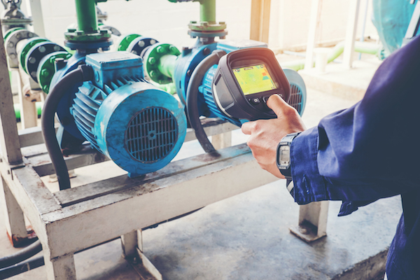
Precision Lenses That Drive Smarter Traffic Monitoring Systems

2025-04-17T11:38:36-04:00

As cities evolve and infrastructure grows more interconnected, traffic monitoring has become a cornerstone of urban planning, road safety, and law enforcement. From toll booths to intelligent traffic systems and public safety networks, modern traffic management relies on real-time imaging—and at the heart of every [...]

Precision Lenses That Drive Smarter Traffic Monitoring Systems2025-04-17T11:38:36-04:00

Custom Lens Assemblies for Panoramic and Surveillance Imaging Systems

2025-04-17T10:17:30-04:00

As demand grows for 360-degree imaging and wide-area surveillance, system integrators and product engineers face challenges in optical performance, resolution, and compatibility. At Universe Kogaku, we don’t build the cameras—we design and manufacture the precision lenses that go inside them. […]

Custom Lens Assemblies for Panoramic and Surveillance Imaging Systems2025-04-17T10:17:30-04:00

Monitoring Livestock Using Imaging Systems

2021-10-13T11:10:41-04:00

Gone are the days when managing and monitoring livestock was entirely dependent on manual labor. Technological advancements have relieved the farmers from such physically demanding and time-consuming tasks. The farms and barns have transformed into modern spaces as they are now outfitted with high-end cameras, [...]

Monitoring Livestock Using Imaging Systems2021-10-13T11:10:41-04:00

Tracking Sea-Level Changes With Satellite Imaging

2021-01-22T12:56:32-05:00

The global sea level has been rising over the past century, and the rate has increased in recent decades. Rising sea levels are a result of global warming and have now become a huge cause of concern. […]

Tracking Sea-Level Changes With Satellite Imaging2021-01-22T12:56:32-05:00

Leveraging Custom Satellite Lenses for Environmental and Climate Change Monitoring Systems

2025-06-16T20:08:17-04:00

Earth observation technologies are transforming how we monitor climate change, manage natural resources, and study environmental shifts.

Leveraging Custom Satellite Lenses for Environmental and Climate Change Monitoring Systems2025-06-16T20:08:17-04:00

The Hidden Potentials Of Earth Imaging

2023-10-24T14:31:15-04:00

Observing Earth’s momentous events from the comfort of our bedrooms is no longer a pipe dream in this day and age. Whenever there is a peculiar phenomenon in the sky, people can witness it on their mobile device — all thanks to all the advancements [...]

The Hidden Potentials Of Earth Imaging2023-10-24T14:31:15-04:00

Hurricane Study And Detection

2020-10-19T13:16:01-04:00

The National Hurricane Center (NHC) has the responsibility of announcing and categorizing all hurricane and cyclone activity in and around North America. This includes the expected track of the storm, the size, rainfall, storm surges and other aspects that go along with Atlantic and Pacific storm formations. These storms are [...]

Hurricane Study And Detection2020-10-19T13:16:01-04:00

Area-Scan Or Line-Scan Cameras

2020-04-28T18:12:25-04:00

There seems to be endless options from which machine vision integrators can choose when it comes to designing an inspection system. Quite possibly the most critical option is whether to use area-scan or line-scan cameras. While the roles they perform are similar, the technology employed in each is miles apart [...]

Area-Scan Or Line-Scan Cameras2020-04-28T18:12:25-04:00

Deep Learning-based Analysis

2020-04-28T18:12:29-04:00

Radiological x-rays, ultrasounds and NMR’s are all forms of medical imaging that have traditionally required the flexibility of the human eye to detect anomalies within the human body. Since a computer is confused by busy backgrounds and image quality issues, it is difficult for a traditional machine vision algorithm to [...]

Deep Learning-based Analysis2020-04-28T18:12:29-04:00
Go to Top