Drones At Work: Part 2 — Surveying & Mapping
Part 1 of “Drones at Work” focused on drones in the agriculture industry. We learned about how drones are constantly proving to be excellent commercial resources for farmers, significantly improving efficiency and reliability.
In part 2, we will look at another industry where drones are quickly becoming more ubiquitous: surveying and mapping.
Drone Technology in Surveying
Land surveying has effectively mapped uncharted lands and delineated private and government borders since early America. George Washington and Thomas Jefferson, the first and third U.S. presidents respectively, were both surveyors who used navigational instruments such as a compass, chains, transits, and sextants to measure land distances, angles, and elevations.
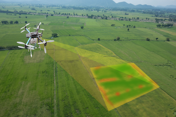
Drone land surveying now adds an extra layer of accessibility, monitoring, precision measurement, and recording. Drone technology enables safe terrain and property mapping, generating high-quality surveying data that matches or exceeds traditional methods. It is also a cost-effective approach to complete more surveying projects in a lot less time.
Whether you are a real estate developer, construction engineer, or a full-service architectural and engineering firm, using drone surveying can save you days (perhaps even weeks) on your project time as well as thousands of dollars in your total costs. It can also provide additional ground images and aerial shots of urban landscapes to streamline your planning and development.
Drones are gaining prominence in the construction industry. As shown in an online Fortune report, construction losses can total upwards of $160 billion in wasted material, time, and effort. One of the biggest reasons construction firms are turning to drones is to maximize their return on investment. Furthermore, according to a third-party survey of 200 respondents in the construction industry who use drone technology, 52% have contemplated employing drones for site surveying, digital infrared thermal imaging (DITI), light-detection and ranging (LiDAR), or other data collection methods before the design or building stages.
However, the same survey showed that 56.6% of those respondents identified the “unmanned aircraft state law landscape” as the biggest hurdle to deploying drones to support their operations. Drone use was also precluded due to concerns such as the safety of the general public and workers on the job site and the high purchase and operating costs of drones.
Advantages of Drones for Land Surveying
- Risk Reduction: Slip and fall accidents caused due to steep terrain or land elevations can dramatically increase construction budgets and disrupt construction operations. When using drones to survey or document building projects, these accidents can be significantly decreased, lowering personal injury and liability risk. Drone use has been associated with reduced accidents and healthcare expenses throughout all stages of construction.
- Faster Acquisition of Data: While “time is of the essence” in the construction industry, data quality is generally valued over and above time. This is because quality information saves time and money in the long run. Drone technology offers the best of both worlds, in that site surveys can be completed at unprecedented speeds while obtaining high-quality data. Drone technology enables each construction project to retrieve data with the right level of accuracy, whether relative accuracy for the information collection or absolute accuracy for engineering.
- Improved Data Resolution: Drones can fly closer to the ground surface and provide considerably higher data resolution for aerial surveying and photography for construction projects that previously employed crewed aircraft to retrieve topographic data. With drone surveys, you can capture problem areas more accurately. Virtual collaboration between all project stakeholders can also be more efficient when cutting-edge surveying solutions are used with cloud-based, high-resolution 3D mapping solutions.
- Access to Unreachable Locations: Drone surveying is most commonly used to measure sites that vehicles and personnel cannot otherwise access. Drone technology is ideal for surveying motorways, waterlogged areas, and congested cityscapes. The technology provides a cost-effective alternative to surveying hazardous areas, allowing surveys to be completed in hours rather than days or weeks.
Drone technology has the potential to revolutionize surveying capabilities in the construction industry. Drones enable surveyors to hit record levels in terms of speed, safety, and profitability. It is no surprise that an increasing number of surveyors are incorporating drones into their surveying arsenal. Of course, a drone is only as good as the lenses used in it. To learn more about specialized lenses for drones, contact the engineers at Universe Optics by calling 516.624.2444.