
Earlier severe storm warnings, more detailed seasonal precipitation forecasts, and improved weather prediction capabilities are all critically important to public safety, national security, and economic growth.
With improved predictability of impending severe weather, people would be able to prepare, or get out of harm’s way, could potentially improve agricultural yields, reduce aircraft delays, ship goods to market in a more efficient manner, and more.
No matter what type of weather, a hurricane, tornado or thunderstorm – predicting how strong a storm will be is part science and part art – and wouldn’t be possible without sophisticated measurement and forecasting technology.
To accurately, or as accurately as possible, create these forecasts, meteorologists use combined observations from atmospheric sensors, weather balloons, radar, satellites, and aircraft, monitoring with complex computer models to predict when a storm will form, where it will strike, and its severity.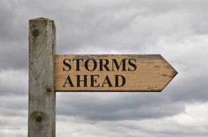
Forecasting a storm is a lot like practicing medicine, said meteorologist Greg Carbin at the National Oceanic and Atmospheric Administration’s (NOAA) Storm Prediction Center (SPC) in Norman, Okla.
“You go to the doctor, you tell the doctor your symptoms and the doctor makes a diagnosis before he makes a prognosis,” Carbin told LiveScience. “We need to diagnose the current state of the atmosphere as best we can before we can attempt to forecast.”
Currently the NOAA (National Oceanic Atmospheric Administration) uses six tools to best predict and track storms.
Doppler Radar:
Doppler Radar is the meteorologist’s window into observing severe storms. With 159 radar towers across the United States, NOAA’s National Weather Service has comprehensive coverage of the continental U.S. and partial coverage of Alaska, Hawaii, Puerto Rico and Guam. Doppler radar detects all types of precipitation, the rotation of thunderstorm clouds, airborne tornado debris, and wind strength and direction.
Weather Satellites:
Weather Satellites monitor Earth from space, collecting observational data our scientists analyze. NOAA operates three types of weather satellites. Polar orbiting satellites orbit the Earth close to the surface, taking six or seven detailed images a day. Geostationary satellites stay over the same location on Earth high above the surface taking images of the entire Earth as frequently as every 30 seconds. Deep space satellites face the sun to monitor powerful solar storms and space weather. NOAA also uses data from satellites operated by other agencies and countries.
Radiosondes:
Radiosondes are our primary source of upper-air data. At least twice per day, radiosondes are tied to weather balloons and are launched in 92 locations across the United States. In its two-hour trip, the radiosonde floats to the upper stratosphere where it collects and sends back data every second about air pressure, temperature, relative humidity, wind speed and wind direction. During severe weather, we usually launch weather balloons more frequently to collect additional data about the storm environment.
Automated Surface Observing Systems:
ASOS (automated surface observing systems) constantly monitor weather conditions on the Earth’s surface. More than 900 stations across the U.S. report data about sky conditions, surface visibility, precipitation, temperature and wind up to 12 times an hour. Nearly 10,000 volunteer NWS Cooperative Observers collect and provide us additional temperature, snowfall and rainfall data. The observational data our ASOS and volunteers collect are essential for improving forecasts and warnings.
Supercomputers:
NOAA’s Weather and Climate Operational Supercomputer System (WCOSS) is the backbone of modern forecasting. With 5.78 petaflop computing capacity it can process quadrillions of calculations per second. Our supercomputers are almost 6 million times more powerful than your average desktop computer. Observational data collected by doppler radar, radiosondes, weather satellites, buoys and other instruments are fed into computerized NWS numerical forecast models. The models use equations, along with new and past weather data, to provide forecast guidance to our meteorologists.
Advanced Weather Information Processing System:
AWIPS (NOAA’s Advanced Weather Information Processing System) is a computer processing system that combines data from all the previous tools into a graphical interface that our forecasters use to analyze data and prepare and issue forecasts, watches, warnings. This system uses NOAA supercomputers to process data from Doppler radar, radiosondes, weather satellites, ASOS, and other sources using models and forecast guidance products. After meteorologists prepare the forecasts, AWIPS generates weather graphics and hazardous weather watches and warnings. All this helps our meteorologists create more accurate forecasts and faster than ever before.
Highly advanced image-processing systems are used in many systems used to collect the data necessary to predict storms and develop models from which information can be passed along to the public. Precision lenses, like the ones available from Universe Optics are on the cutting edge of new technology. Our commitment is to always stay on top of the ever-evolving advancements in relationship to imaging systems in a wide variety of disciplines, including meteorological breakthroughs.