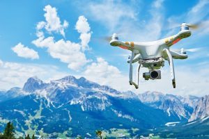
With todays’ advancements in technology, emergency personnel and government agencies are now able to capture images of structural damage using digital aerial cameras. These digital aerial images or photogrammetry, are highly valuable in situations of a natural disaster, such as an earthquake or flood. Being able to see those images immediately will aid rescue workers in reaching victims. Using remotely sensed data obtained from satellites and airborne platforms is useful in providing an understanding of the distribution of damage due to natural disasters. The images will also allow them to see where there is potential of more collapse and/or damage.
In 2008, a research project conducted by Eucentre (European Centre for Training and Research in Earthquake Engineering), based in Pavia, Italy, was using a vision-based analysis system to assess the level of structural damage in test buildings subjected to earthquake simulations. The aim of the project, funded by the Italian Civil Protection Department and Foundation Cariplo, was to determine how stable existing buildings are during and after an earthquake. The findings of the project were to be used to verify the efficiency of rules for seismic assessment and repair of existing buildings.
The research team, headed by Professor Alberto Pavese, developed the vision system using high-resolution cameras (2,352 x 1,728 resolution with a frame rate up to 120fps). A scaled 1:2 multi-story building representing 50s or 60s construction was built on a shake table to simulate the conditions of an earthquake. Infrared reflectors were placed on the walls of the building in a set pattern, with the cameras recording their motion to analyze the displacement of the structure.
‘The system was used to gather information from the structure that can provide an idea of the level of damage before and after an earthquake,’ explained Pavese. ‘From the data, decisions can be made on whether the structure is repairable or whether it would have to be demolished.’
Traditionally, accelerometers have been used in the analyses of the vibrations moving through structures in post-earthquake research. Accelerometers can only be used to produced readings from the point from which they come in contact to the structure. Using digital aerial images, however, provides much more information about the damage. Pavese commented: ‘The system provides a comprehensive set of data regarding the behavior of the structure, much more so than using accelerometers.
At UKA, we design and manufacture high-precision lenses for digital aerial cameras with a team of highly skilled developers and engineers. Our services are all conducted in-house to ensure the highest quality manufacturing of your specific lens.
Not only will these images be able to show the structures that are damaged, but, will also give the information of what structures may not be damaged. Having that information in hand before workers are on-scene will save valuable time and resources when it comes to rescue efforts.
Universe Kogaku designs and manufactures optical lenses for digital aerial cameras, security, high tech and electronic applications. We stock 1000’s of standard lens assemblies and can custom design a solution for scanners, CCTV, CCD/CMOS, medical imaging, surveillance systems, machine vision and night vision systems.